

Trial of a Process for the Identification of Reduced Depth of Cover on Buried Pipelines
Third-party interference is widely documented as being a major cause of damage to buried pipelines. In addition to routine surveillance, maintaining a minimum depth of cover is recognized as a key means of mitigation against third-party interference. We know that the depth of cover over pipelines can change with time. Current techniques available for measuring depth of cover on buried pipes require significant effort to produce a high-resolution survey for an entire pipeline.
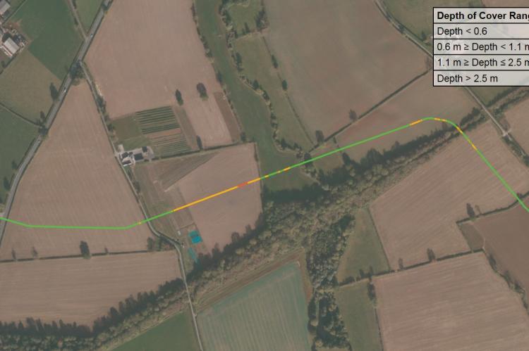
A UK Innovation project completed for National Grid Gas Transmission has successfully demonstrated a methodology to identify reduced depth of cover over an entire pipeline. This methodology combines ground elevation data with high-resolution inertial measurement unit (IMU) data collected during inline inspection to calculate the pipeline depth of cover.
GPS and pipe depth measurements have been used to verify the accuracy of this method. Using the pipe centerline derived from the IMU data, and ground elevation data collected using light detection and ranging (LiDAR) techniques, depth of cover has been calculated to an accuracy of ±0.149 m root mean square error.
This paper describes the key project steps associated with planning, data collection, data processing, and the validation of results to demonstrate that pipeline depth of cover over an entire pipeline can be accurately determined.